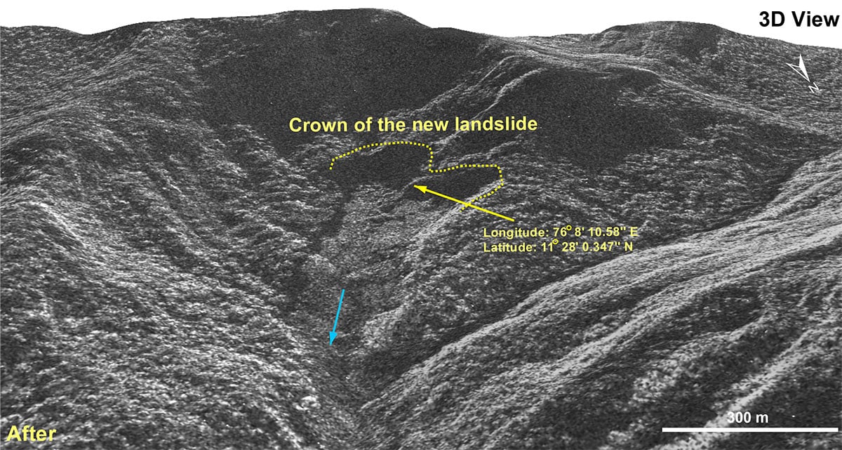
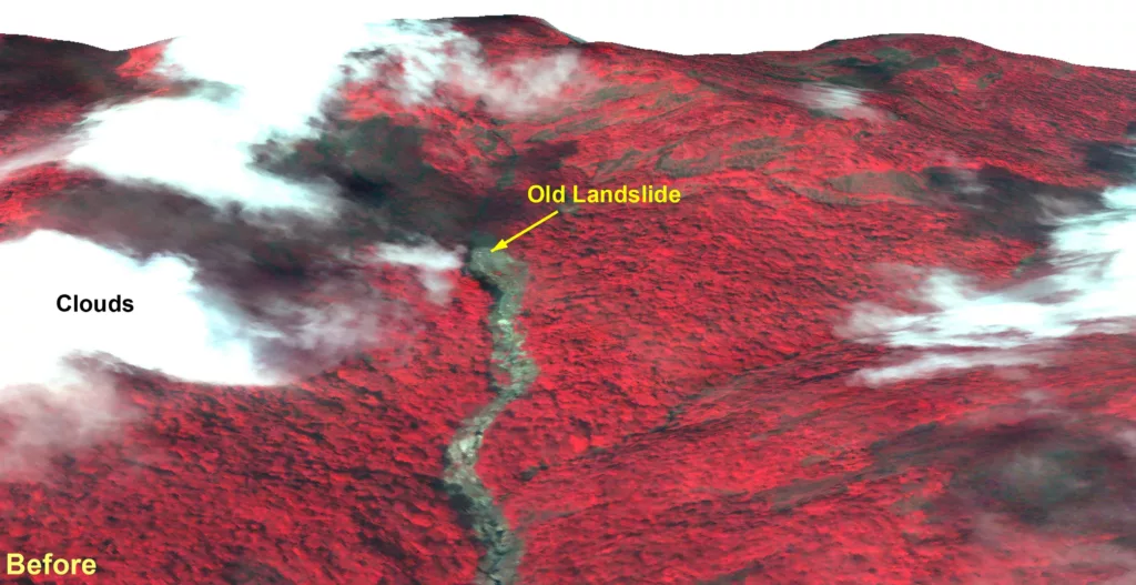
High resolution images taken by Indian satellites show the widespread damage and devastation caused by landslides in Kerala’s Wayanad. More than 150 people have died and over 200 injured even as the rescue works are ongoing. The before and after images show that about 86,000 square meters of land slipped and the debris flowed for about 8 kilometers along the Iruvaiphuzha river.
Interestingly the Indian Space Research Organisation report also presents evidence of an old landslide at the same location, suggesting its vulnerability was documented.
The National Remote Sensing Center, Hyderabad a part of the Indian Space Research Organization deployed its highest resolution Cartosat-3 optical satellite and the RISAT satellite that is capable of seeing through cloud cover. The space agency says the landslide was initiated at an altitude of 1550 meters above the sea level.
The latest report accessed by NDTV, suggests that there is evidence of an old landslide at the same location. A 2023 ‘Landslide Atlas of India’ prepared by ISRO had placed Wayanad region as a vulnerable to landslides.
Photo Credit: NRSC/ISRO
ISRO satellite images show widespread devastation at Wayanad landslide. Almost 86,000 square meters of land slipped causing the landslide almost five times the size of the Rashtrapati Bhawan. The debris flowed for almost 8 kilometers downstream washing away towns and settlements.
ISRO says there is evidence of an old landslide at same location. The National Remote Sensing Center used the Cartosat-3 satellite and the RISAT satellite to see through cloud cover.
The NRSC reports says “a major debris flow was triggered by heavy rainfall in and around the Chooralmala town of Wayanad District in Kerala state of India”. As per latest reports, more than 100 people are dead and many are missing.
Very high resolution RISAT SAR images of 31 July, 2024 show the entire extent of the debris flow from crown to end of run out zone. The approximate length of the flow is 8 km. The crown zone is a reactivation of an older landslide. The size of the main scarp of the landslide in 86,000 square meters. The debris flow has widened the course of the Iruvaniphuza River causing breach of its banks. Houses and other infrastructures located along the banks have been damaged by the debris flow, 3D rendition of the crown of the landslide illustrates that a large section of the hill slope has been affected.

Photo Credit: NRSC/ISRO
The areal extent of the landslide is 86,000 square meters. The crown is located at an approximate elevation of approximately 1,550 m above MSL.
ISRO prepared a “Landslide Atlas of India” which diligently documents the 80,000 landslides that have occurred over 20 years and lists landslide from Puthumala, Wayanad district, and large parts of Kerala are marked red as being prone to landslides.
Dr S Somanath, the Chairman of ISRO in the 2023 report says it presents “the overall landslide scenario in India and … the field of landslide hazard. I am sure that the atlas will be beneficial to everyone involved in disaster management endeavors.”
